| School | Distance | Magnitude |
|---|---|---|
| Williamsport | 88 | 3.8 |
| North East | 75 | 3.8 |
| James Bennett | 164 | 3.6 |
| Williamsport | 88 | 3.65 |
| Smithsburg | 78 | 5.6 |
| Lackey | 180 | 4.0 |
| Northern | 216.5 | 3.63 |
| Havre de Grace | 152.5 | 3.1 |
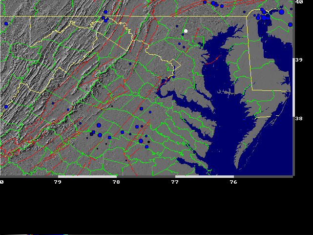
The fall simulated earthquake had an epicenter at Reisterstown. Specifically, the program used to generate the
seismograms, used a location of 39.5 N and 76.8 W. The magnitude was set at 3.7. The generating program used the
algebraic equation to calculate amplitude of the wave from the input magnitude. The nomogram will give
magnitude within +/- .3 or so units.
The logic behind the choice of site and magnitude can best be explained
by observing the historic data. On the map below, fault lines appear in orange and historic earthquakes in blue.
Reisterstown is represented by the white dot. It can be seen that while Reisterstown does not lie on a fault,
it is near a cluster of earthquakes.
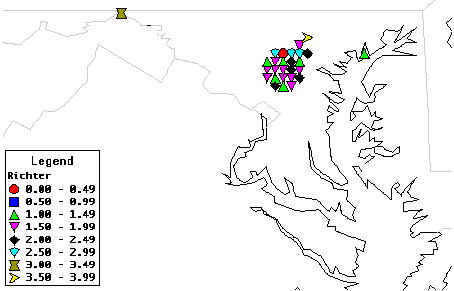
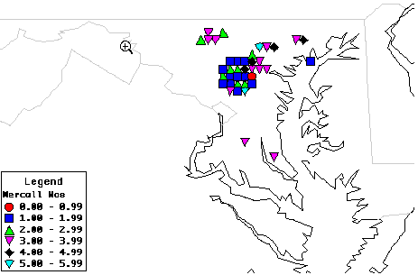
The next two maps were created using Alice software and data found on the Earthquakes in Maryland page. The first map uses Richter numbers while the second uses Mercalli numbers. The two maps will show differences because values on both scales were not available for all earthquakes.