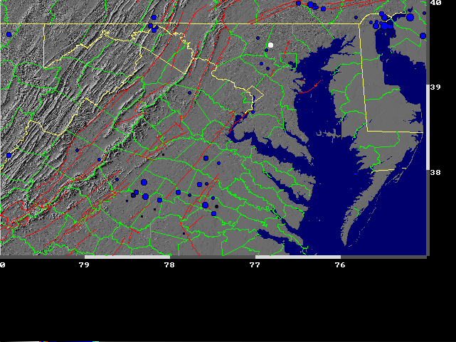
The logic behind the choice of site and magnitude can best be explained by observing the historic data. The first map below was generated using The Maryland Earth Science CD-ROM which was produced by NASA and the Joint Education Initiative at University of Maryland, College Park. On this map, fault lines appear in orange and historic earthquakes in blue. Reisterstown is represented by the white dot. It can be seen that while Reisterstown does not lie on a fault, it is near a cluster of earthquakes.
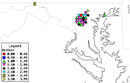
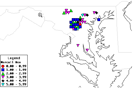
The next two maps were created using Alice software and data found on the Earthquakes in Maryland page. The first map uses Richter numbers while the second uses Mercalli numbers. The two maps will show differences because values on both scales were not available for all earthquakes.
 Return to Earthquake Project Page
 Return to WHS Home Page