
Your task is to better manage the RiverWeb watershed to "clean up" the streams and rivers. First, examine the conditions at the river stations (0-7).Then, reduce pollutants by making improvements in land use practices.
We suggest you start at Station 7, the River Mouth.
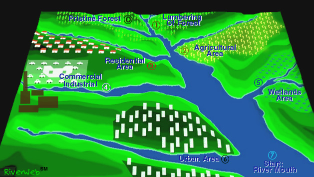
The RiverWeb Water Quality Simulator illustrates the causes of non-point source pollution within an "archetypal watershed." The watershed consists of seven subregions. Subwatershed 0 drains pristine forest. Water quality indicators provide information about how the land use for the other subregions affects the water quality at the mouth of the river. You can investigate how precipitation and land use affect indicator values and reduce pollutants by improving the management of the subregions.
Map Links:
Station 0 Station 1 Station 2 Station 3 Station 4 Station 5 Station 6 Station 7